Geography Test Yourself
Here's a really quick way of testing if you've learned the meanings of the key words in this section.
Look at the key word on the card and see if you can remember its definition.
If you get stuck, you can be shown the mnemonic to reveal an image that should help you remember.
To check if you're right, or remind you if you've forgotten, press the card to flip it.
Go through the whole list to see how many definitions you can recall.
Revisit any that you had difficulty remembering until you're confident you can
recall all of them.
Interlocking Spurs
A series of ridges projecting out on alternate sides of a valley and around which a river winds its course
Interlocking Spurs – A series of ridges projecting out on alternate sides of a valley and around which a river winds its course
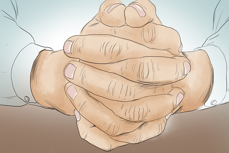
Interlocking fingers remind us of interlocking spurs because that is exactly what interlocking spurs look like.
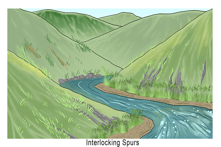
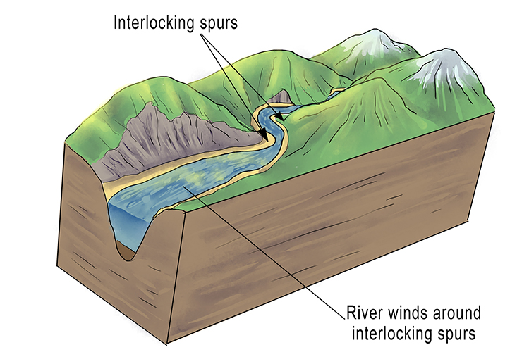
Interlocking slopes are convex (rounded) slopes that extend alternately from opposite sides of a valley, each one fitting into the "gap" between two similar slopes on the other side. They fit together rather like the teeth of a zip.
Interlocking spurs are created over vast periods of time by a river eroding the landscape in its upper course. The river winds and bends as it meets resistance from harder rock.
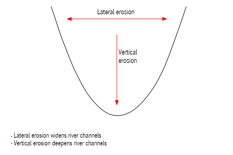
Lateral Erosion
Sideways erosion by a river on the outside of a bend
Lateral Erosion – Sideways erosion by a river on the outside of a bend
It eventually leads to the widening of the valley and contributes to the formation of the floodplain
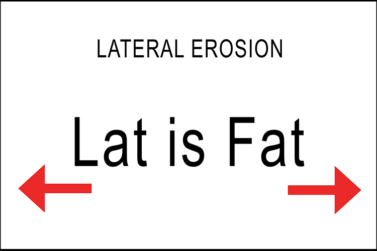
"Lat is fat" will remind you that lateral is the movement sideways, not down.
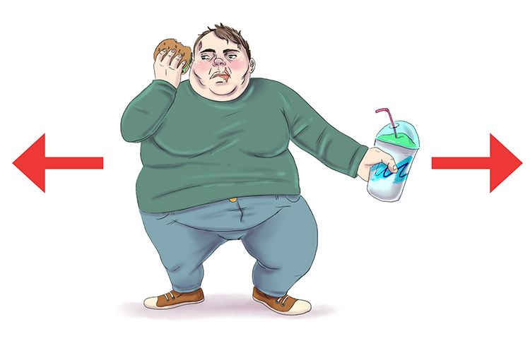
"Lat is fat" – he keeps growing sideways.
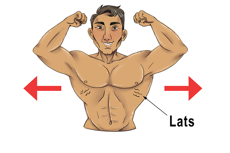
Remember, if you are a bodybuilder your lats come out sideways on your back. This helps remind you that lateral is the sideways movement.
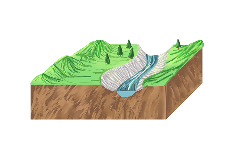
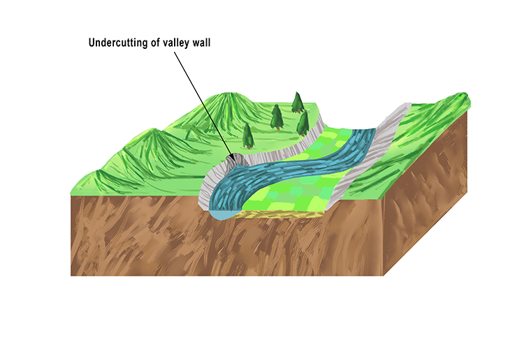
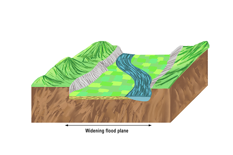
These three images show how a flood plane widens in stages as a river meanders, altering course over time.
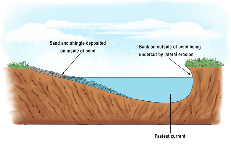
This cross-section view shows some of the key features of a meander in a river. Erosion occurs where the current is fastest.
Lateral erosion occurs on the outside (longest side) of a river bend. It causes undercutting of the riverbank, eventually forming a small cliff.
On the inside (shorter side) of the bend, there is less water, so friction causes it to slow down, lose energy and deposit the material the river is carrying, creating a gentle slope.
The build-up of deposited material eventually results in what is known as a slip-off slope, or river beach.
Levee
Embankment alongside a river which may be formed naturally by sediment or built up by people to protect against flooding
Levee – Embankment alongside a river which may be formed naturally by sediment or built up by people to protect against flooding
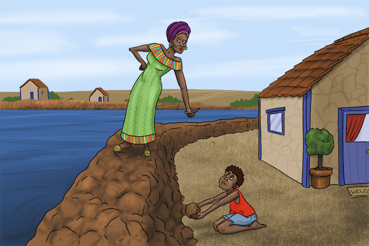
Leave these (levees) stones on the bank, they are here to protect us!
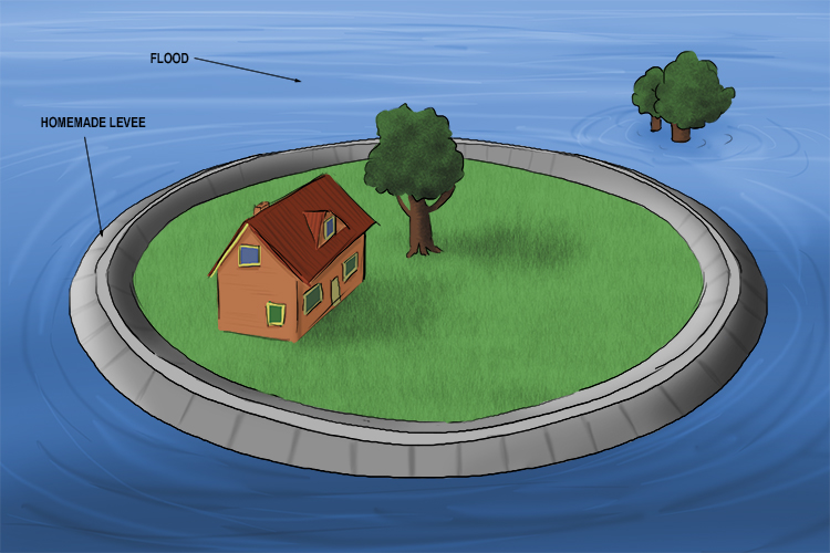
House protected by a homemade levee:
Formation of natural levees:
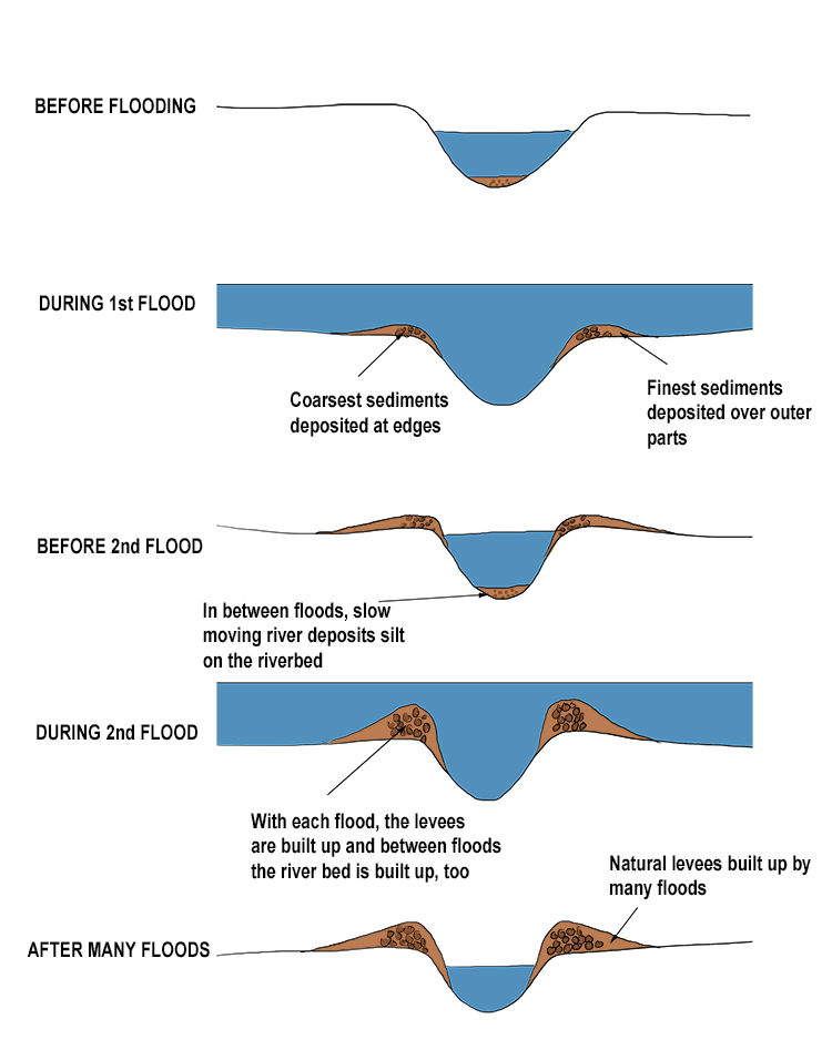
The natural movement of a river can push sediment (small particles carried in the water) to the side, creating a natural levee. The banks of the river become slightly elevated from the riverbed. In some cases, this results in a natural flood barrier.
Artificial levees are usually constructed from soil, sand or rocks. Where the flow of a river is particularly strong, levees may be made of blocks of timber, plastic, or metal.
If an area alongside a river is in particular danger, the levee might be reinforced by concrete.
Long Profile
The gradient of a river from its source to its mouth
Long Profile – The gradient of a river from its source to its mouth
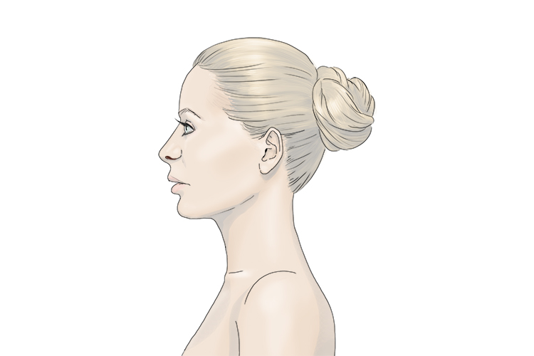
A profile is an outline of something.
Just like a person has a profile, a river has one too. The long profile of a river is from top to bottom, or source to mouth (see below):
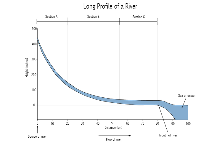
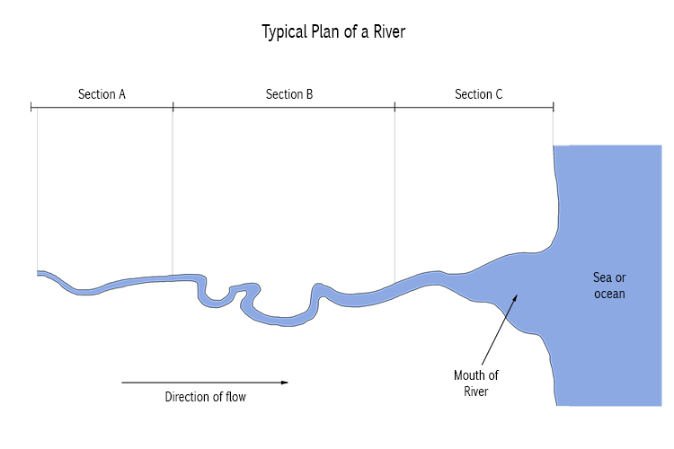
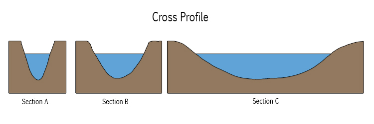
A long profile shows how a river changes over its course.
The upper course, where the river starts, is usually in an upland area. The river is narrower and faster-flowing here, its bed is usually V-shaped, and the particles carried by the water are relatively large.
In the lower course, the land is generally much flatter. The riverbed is more U-shaped and the particles in the water are more likely to be fine sediment, as erosion has broken down the larger pieces.
Meander
Pronounced bends in a river
Meander – pronounced bends in a river
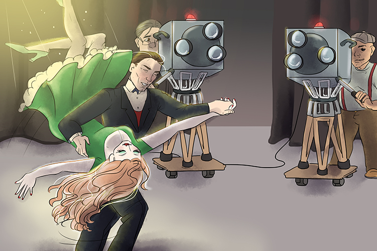
"Me and Her" (meander) was the name of the film and it was about how much we had to bend when we danced.
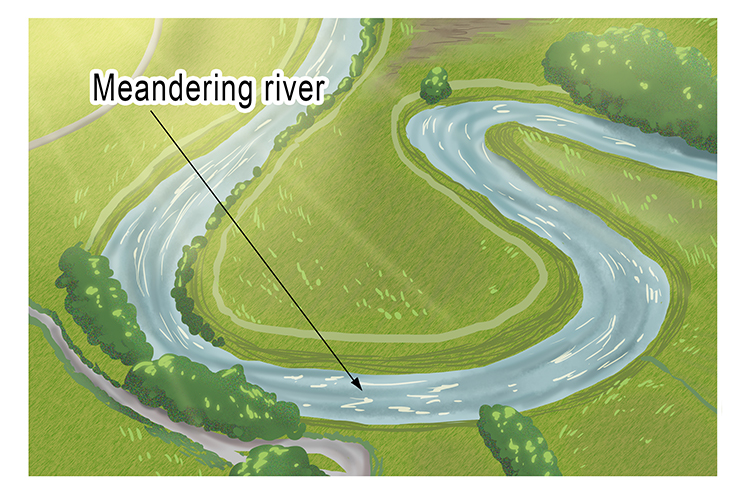
Meanders, or a series of bends, in a river usually occur in the lower reaches, where the land slopes gently, as opposed to the steeper slopes of the upper reaches.
These meanders are formed as the river erodes laterally, to the right side then the left side.
Over long periods of time, this action creates bends, which can become large loops shaped like horseshoes.
Ox-bow Lake
An arc-shaped lake which has been cut off from a meandering river
Ox-bow Lake – An arc-shaped lake which has been cut off from a meandering river
To learn what an ox-bow lake is, it helps if you know what an ox bow is:
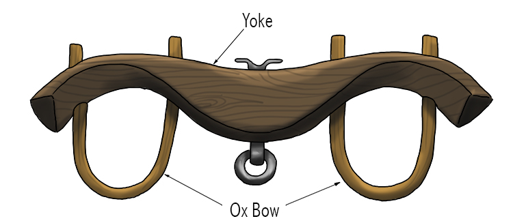
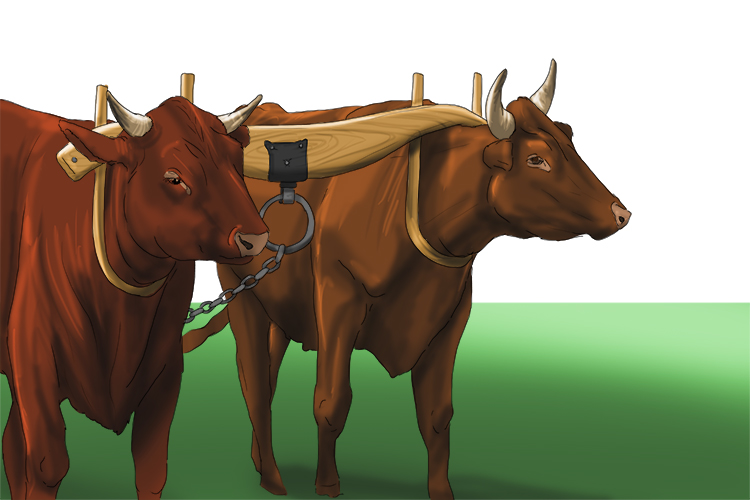
As you can see, an ox bow is a U-shaped piece of wood used as a collar for an ox, the upper parts fastened to its yoke.
So, now you can see that an ox-bow is U-shaped, you can recognise an ox-bow lake, as below:
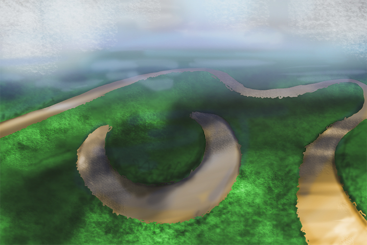
It will help you further if you know how they are formed:
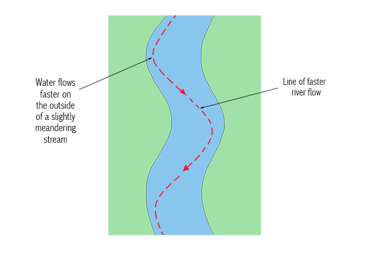
The outside of the bends are eroded while particles carried by the water are deposited on the insides:
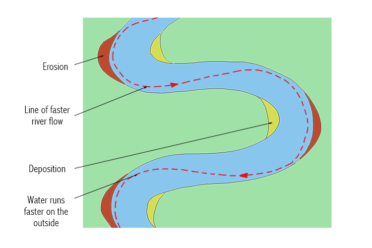
Over time, the bend changes shape:
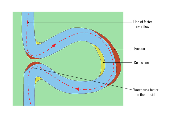
The river eventually flows through the remaining narrow gap and the land is sealed off by further deposits from the water, leaving behind an ox-bow lake:
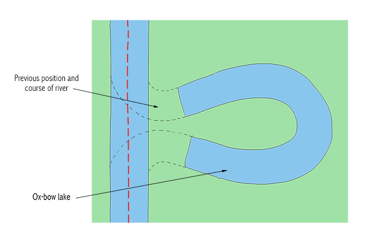
The last stage of the formation of the ox-bow lake often happens during a flood, when the river cuts through the narrow neck of the meander.
As the river continues on its new, straighter path, the meander is abandoned.
The fastest current will now be flowing in the centre of the river channel and deposition is more likely to occur beside the banks.
New deposition seals off the ends and the cut-off becomes an ox-bow lake.
Precipitation
Moisture falling from the atmosphere as rain, hail, sleet or snow
Precipitation – Moisture falling from the atmosphere as rain, hail, sleet or snow
(Pronounced pruh-si-puh-tay-shun)
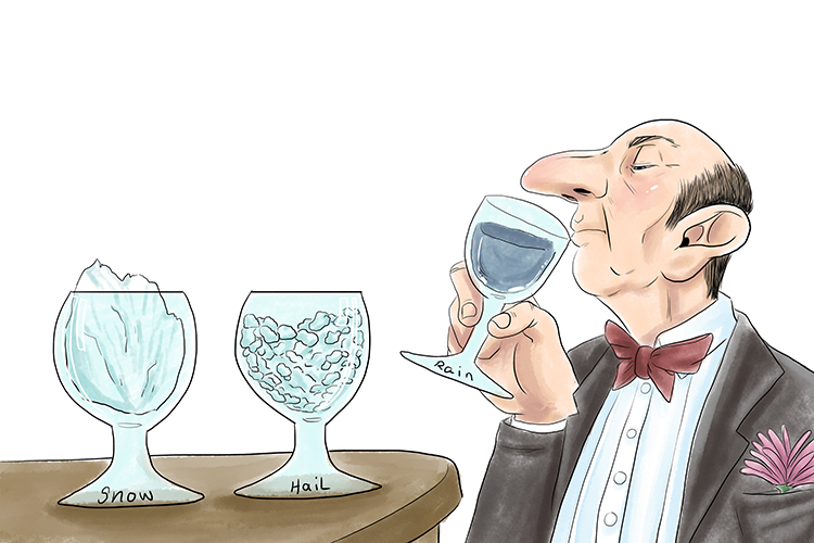
The purpose of sipping at the tasting station (precipitation) was to see if snow, hail and rainwater had different tastes.
Precipitation is a form of water from the atmosphere. It is a term used in meteorology (the study of the weather) and includes rain, snow, sleet, ice pellets dew, frost, and hail.
Each of these is formed by condensation from water vapour in the atmosphere and falls under gravity.
NOTE: Fog and mist are not precipitation but suspensions of water droplets that obscure your vision. In other words, they are not falling under gravity, but are suspended in the air.
To measure rainfall, weather forecasters use a tipping bucket:
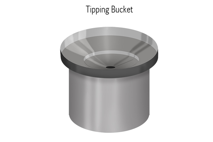
The tipping bucket is left outside and captures rain to measure.
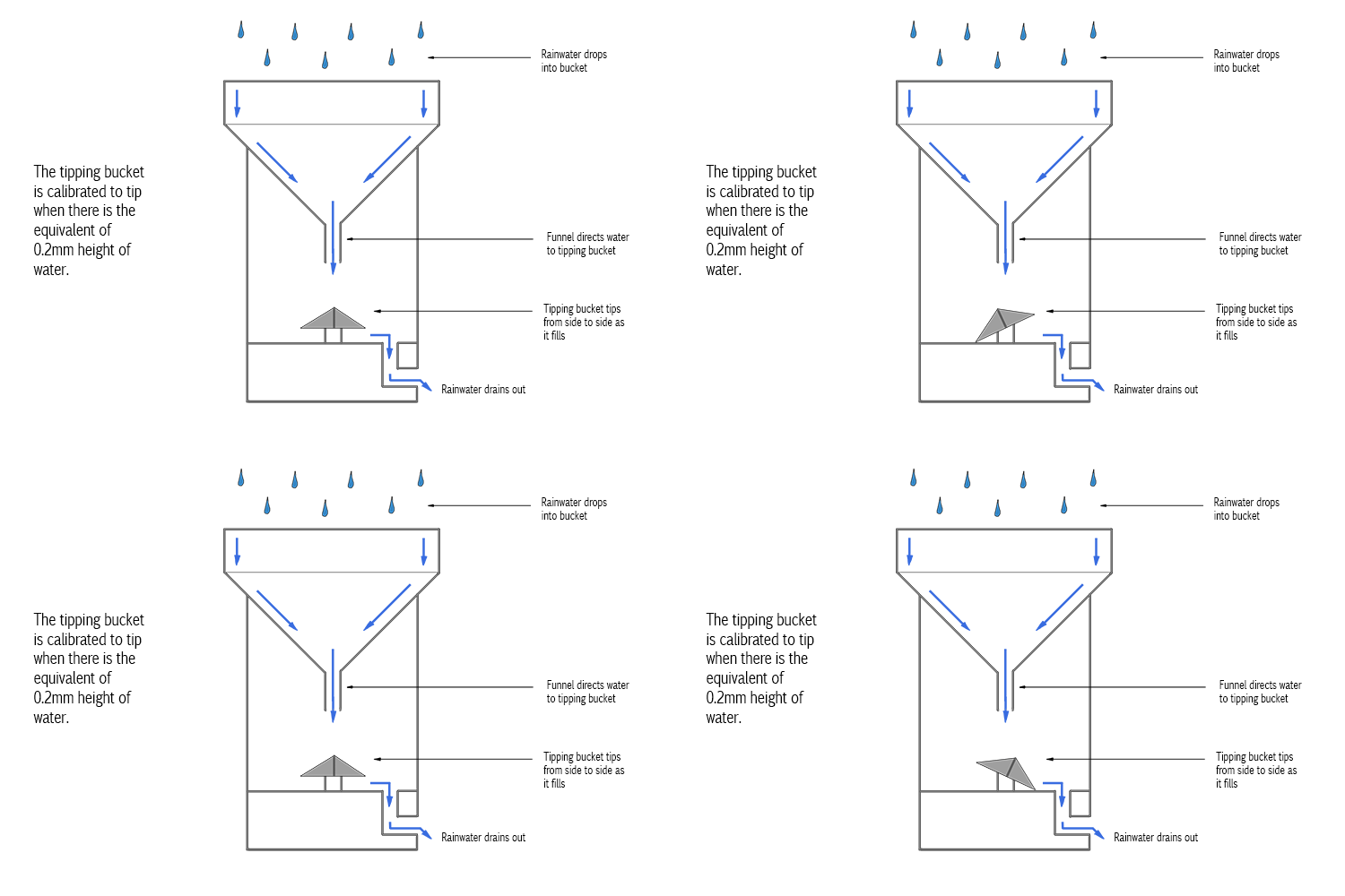
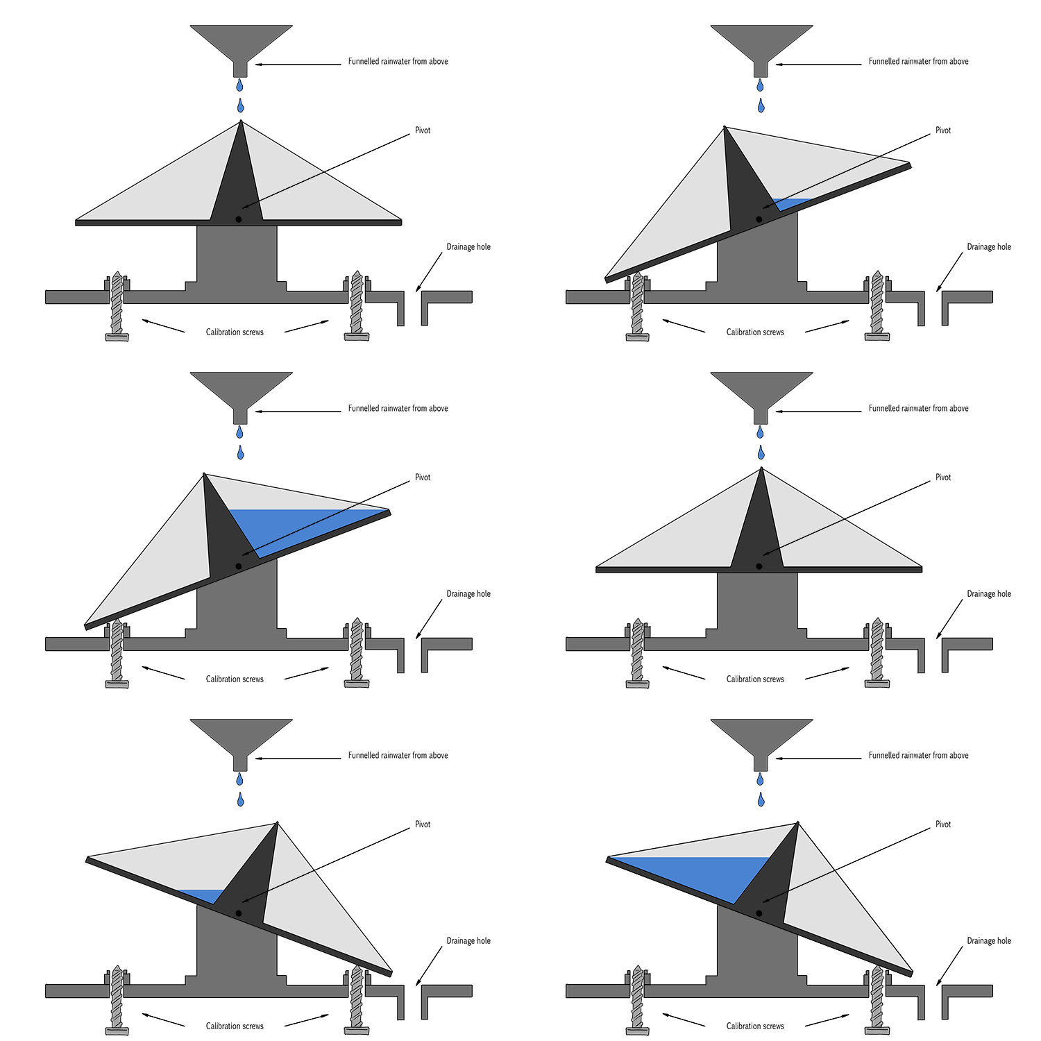
There are physically two buckets. When one of the buckets fills up to the equivalent of 0.2mm of water, that bucket tips, allowing the second to fill. Every time the buckets tip, they send an electrical signal to a computer to record how many times this happens. Computers can then easily work out how much rain falls in any set period of time, for example:
Slight rain= 0.5mm per hour
Moderate rain= Greater than 0.5mm per hour but less than 4.0mm per hour
Heavy rain= Greater than 4.0mm per hour but less than 8mm per hour
Very heavy rain= Greater than 8mm per hour
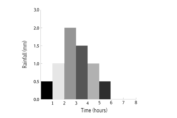
Weather forecasters then put this information on a graph:
Vertical Erosion
Downward erosion of a river bed
Vertical Erosion – Downward erosion of a river bed
VERTICAL EROSION
VERTICAL EROSION
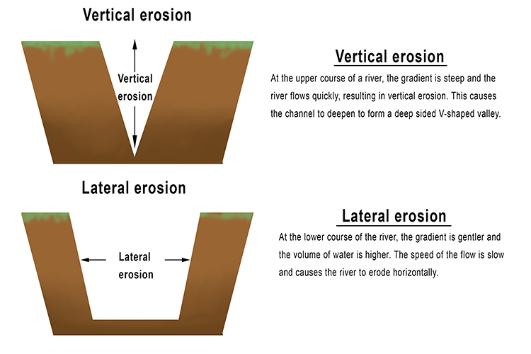
Vertical erosion makes a river channel deeper. The 'V' of vertical should help you remember the V-shaped valleys that are created by this action.
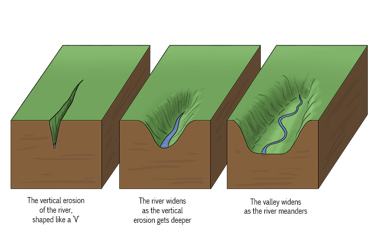

When the rate of discharge in the upper reaches of a river is high, the riverbed is eroded downwards, usually into a V-shape. This is called vertical erosion. It happens due to the speed of the water and relatively large size of the rock particles it contains.
Lower stretches of the river move slower and the river's load – the sediment it carries – becomes much finer. Here, the river is more prone to lateral erosion (the erosion of the sides, or banks).
Hydrograph
A graph which shows the discharge of a river, related to rainfall over a period of time
Hydrograph – A graph which shows the discharge of a river, related to rainfall over a period of time
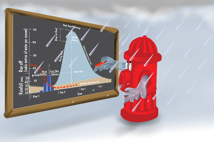
The hydrant drew a graph (hydrograph) of the amount of water that it discharged at different times. When it rained it had to include this water too.
It's a graph that combines the plotting of the water flow rate of a river and the rate of rainfall over time.
Below is the graph of the water flow rate of the river at a particular point along its course:
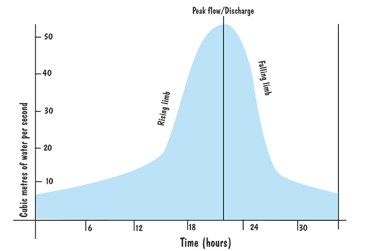
Graph of water flow rate (discharge of a river):
Note: the cubic metres of water per second (also known as "cumecs") is calculated by multiplying the cross-sectional area of the river by the average velocity of the river. See Discharge.
Below is the graph of the amount of rainfall during and around this period of time:
Graph of rainfall in the area around the river measured in mm per hour.
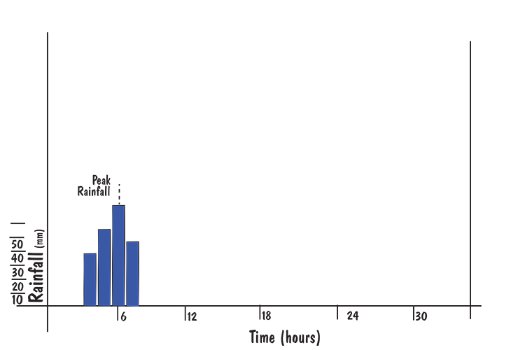
Note: The way this information is collected can be seen in Precipitation.
Meteorologists (weather experts) combine these two graphs to form a single graph called a hydrograph:
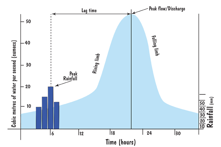
Hydrograph
This hydrograph shows a bar chart of the amount of rainfall per hour measured in mm and a line graph measured in cubic metres of water per second (cumecs) passing a point in a river.
The peak rainfall is the time of highest rainfall but there is a delay between that and the peak discharge of the river. This delay is because it takes time for the water to find its way to the river.
The difference in time between these two peaks is called the lag time.
Waterfall
Sudden descent of a river or stream over a vertical or very steep slope
Waterfall – Sudden descent of a river or stream over a vertical or very steep slope
We all know what a waterfall is, but how do they form?
It often forms where the river meets a band of softer rock after flowing over an area of more resistant material.
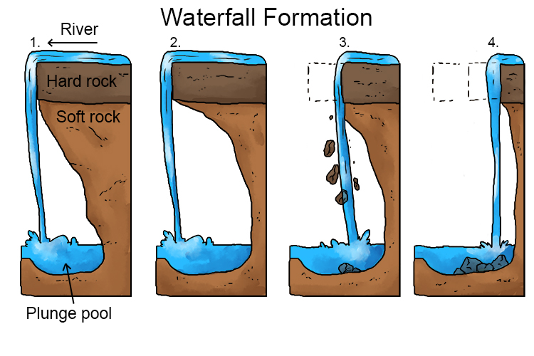
- Waterfalls typically form in the upper stages of a river. They occur when a band of hard rock overlies a softer rock. Falling water and rock particles erode the soft rock below the waterfall, creating a plunge pool.
- The soft rock is undercut by erosional processes such as hydraulic action and abrasion, creating a plunge pool where water and debris swirl around, eroding the rock and creating an overhang.
- The hard rock overhang above the plunge pool collapses as its weight is no longer supported.
- Erosion continues and the waterfall retreats upstream, leaving behind a gorge.
River Soft Engineering
Use of the natural environment surrounding a river for schemes that work with the river's natural processes
Soft Engineering – Use of the natural environment surrounding a river for schemes that work with the river's natural processes
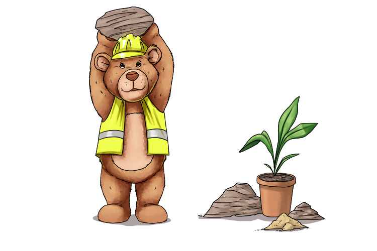
The soft engineer (soft engineering) wasn't really that soft - he used stones, sand and other materials as well as plants.
Examples of soft engineering around rivers:
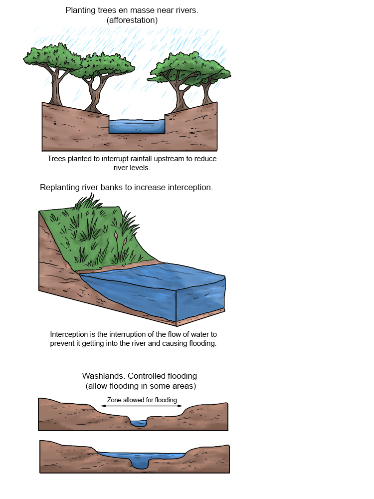
Soft engineering avoids the use of artificial materials, taking a more sustainable and natural approach to managing river landscapes.
Compared to hard engineering, soft engineering is generally less expensive, more long-term, attractive, and sustainable.
Soft engineering in river landscapes is usually aimed at flood prevention.
Examples include planting vegetation to help reduce run-off of rainwater into the river, and dredging – excavating sediment from the riverbed to improve its flow. The excavated sediment may be placed along banks to further help prevent flooding.
Glacial Abrasion
Erosion caused by rocks and boulders in the base of a moving glacier scraping the rocks below
Abrasion – Erosion caused by rocks and boulders in the base of a moving glacier scraping the rocks below
(Pronounced uh-brey-zhuhn)
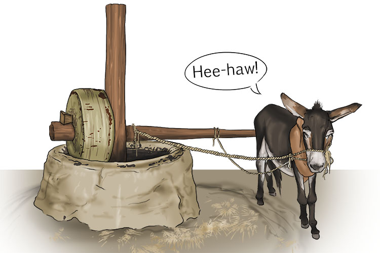
You could hear the brays from (abrasion) the donkey as she wore down and ground down the corn.
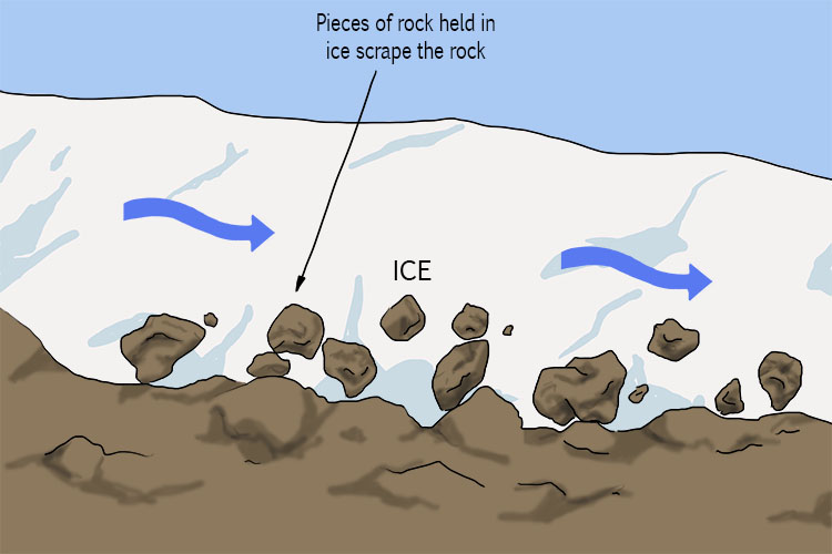
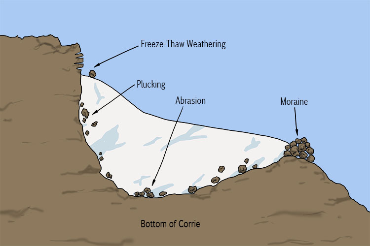
As a glacier moves slowly downhill it carries with it rocks that have been frozen to its base and sides. These accumulated rocks scrape the earth beneath like sandpaper, gouging shapes into the landscape over a period of many years. This is the process we refer to as abrasion.
You could say that a glacier moulds itself to the shape of the land, and also moulds the land as it inches down the valley.
NOTE: The typical movement of a glacier is about 25cm (10 inches) per day.
Arête
A sharp, knife-like ridge, formed by process of erosion and freeze-thaw weathering
Arête – A sharp, knife-like ridge, formed by process of erosion and freeze-thaw weathering
(Pronounced ah-ret)
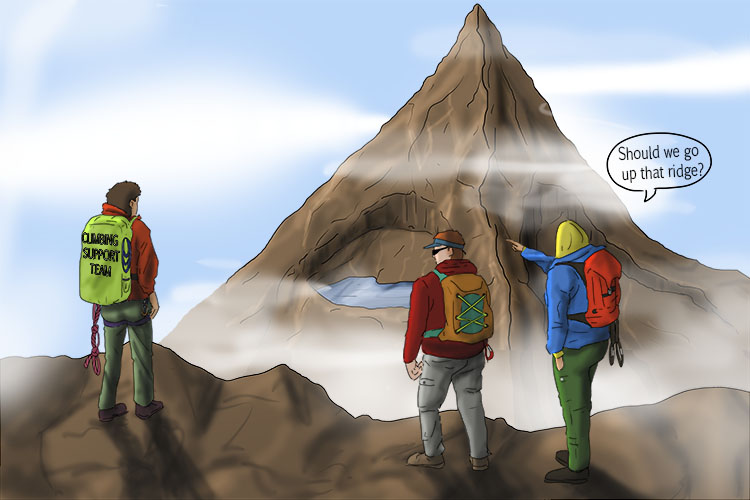
The climber had a retinue (arête) of guides who advised that the edge was too sharp and knife-like to climb.
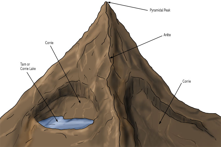
An arête is usually formed when two glaciers erode parallel, U-shaped valleys, or when two corries (cirques) erode next to each other. The edge of the arête is sharpened by freeze-thaw weathering and the slopes either side are made steep by the erosion of unstable rock.
Bulldozing
Ice pushes material of all shapes and sizes as it moves slowly forward
Bulldozing – Ice pushes material of all shapes and sizes as it moves slowly forward
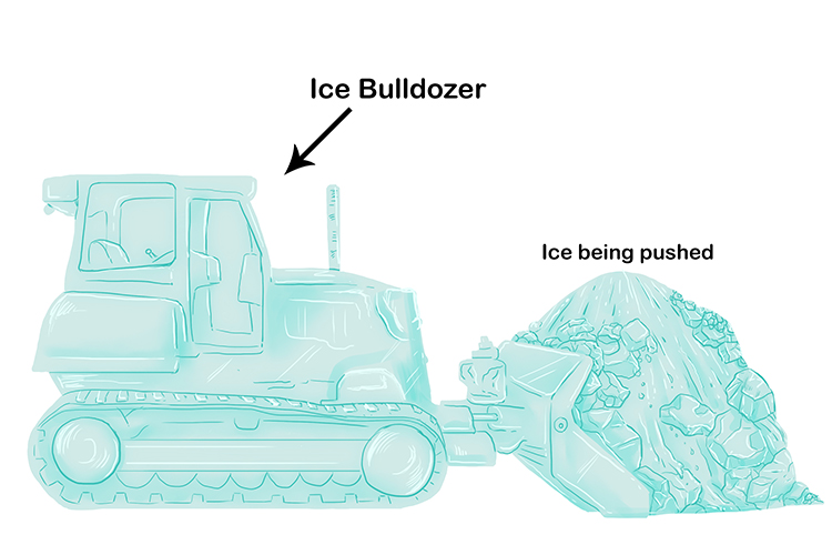
The bulldozer (bulldozing) is made of ice and pushes ice and material forward.
As gravity pulls the glacier downhill the ice will slowly move, scraping and bulldozing everything in its path.
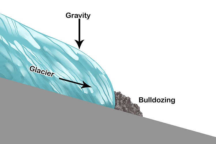
Glaciers are frozen rivers of ice which have immense power. They can carve huge chunks out of mountains as they move downhill. Some of the debris picked up by the moving glacier is piled up at the front of the moving ice and is pushed along. This is called bulldozing. You could say that glaciers are nature's bulldozers.
Drumlin
A hill made of glacial till deposited by a moving glacier, usually shaped like half an egg
Drumlin – A hill made of glacial till deposited by a moving glacier, usually shaped like half an egg
(Pronounced drum-lin)
NOTE:
The drumlin is usually elongated or an oval shape, with the longer axis parallel to the former direction of ice movement.
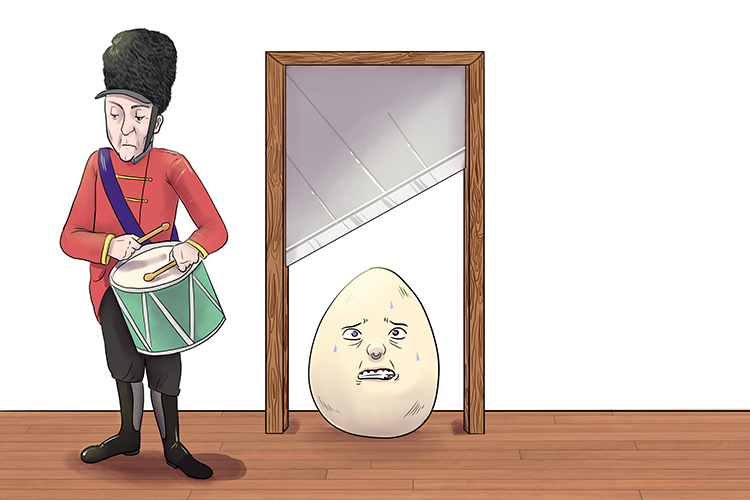
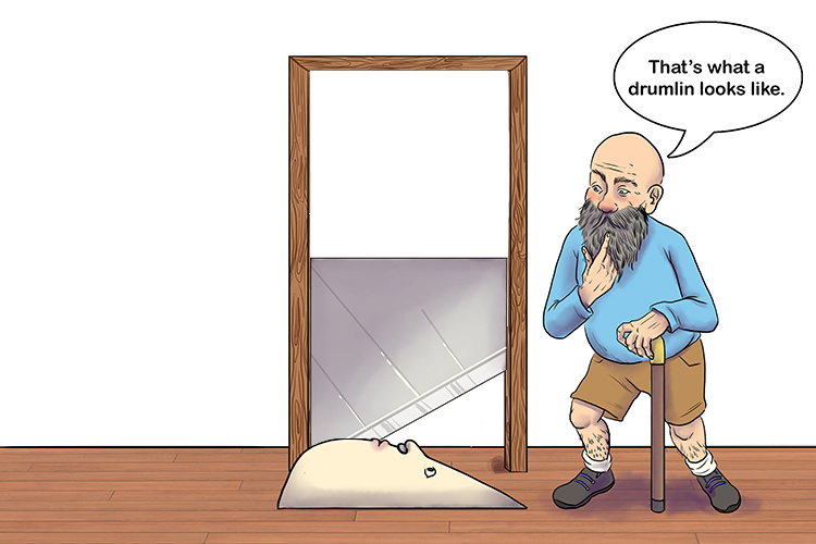
The drummer lined (drumlin) up and did a drum roll as the egg was chopped in half. As it rolled on to the floor somebody noticed the half egg was the same shape as a drumlin.
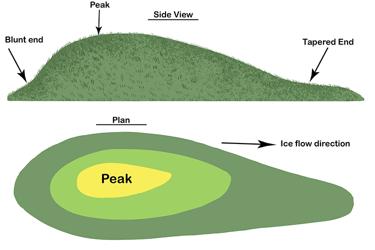
NOTE:
The diagram shows the glacial deposit with grass having grown over it.
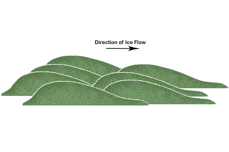
Drumlins are shaped like half an egg. They tend to exist in "swarms" rather than as isolated, individual hills – a swarm can contain tens to thousands of drumlins. All of the drumlins in a swarm are lined up in the same direction.
Most drumlins have their highest elevation (blunter end) pointing in an upstream direction, with the more gently sloping and pointed end, or tail, pointing downstream. The way to remember this is:
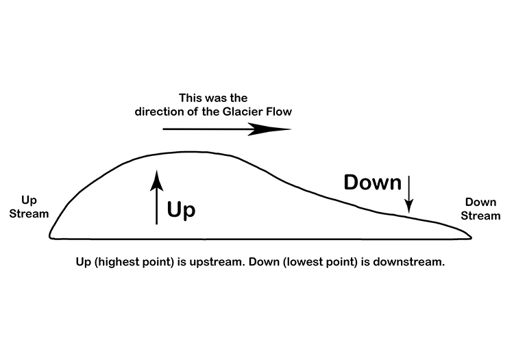
The upstream blunt end is called the stoss end and the downstream end is called the lee.
Erratics
Rocks which have been transported and deposited by a glacier some distance from their source region
Erratics – Rocks which have been transported and deposited by a glacier some distance from their source region
(Pronounced ih-rat-ik)
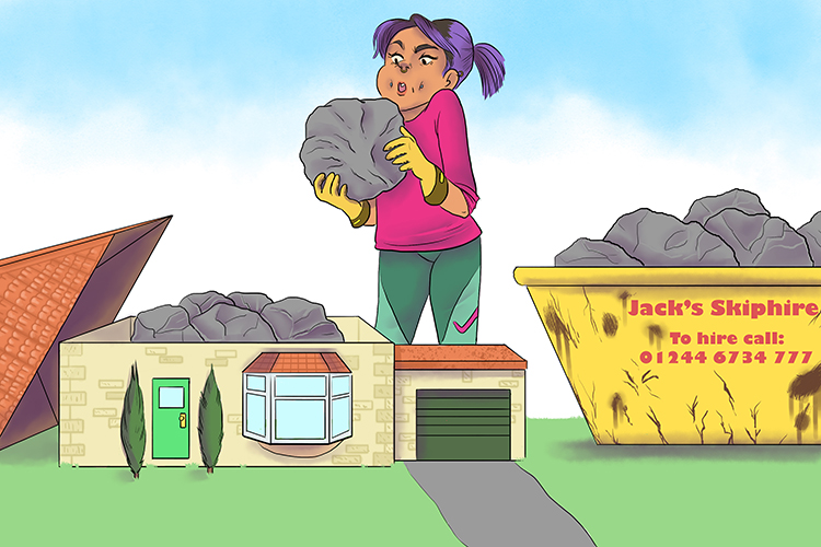
Her attic (erratics) was full of rocks and she threw them into a skip to be transported and deposited some distance away.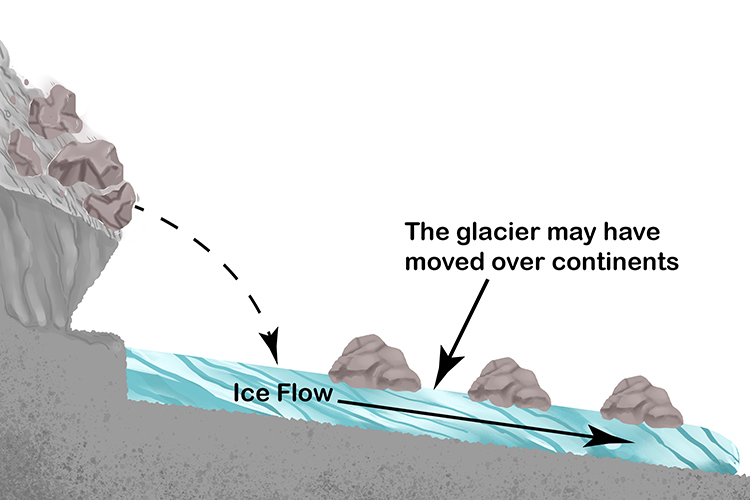
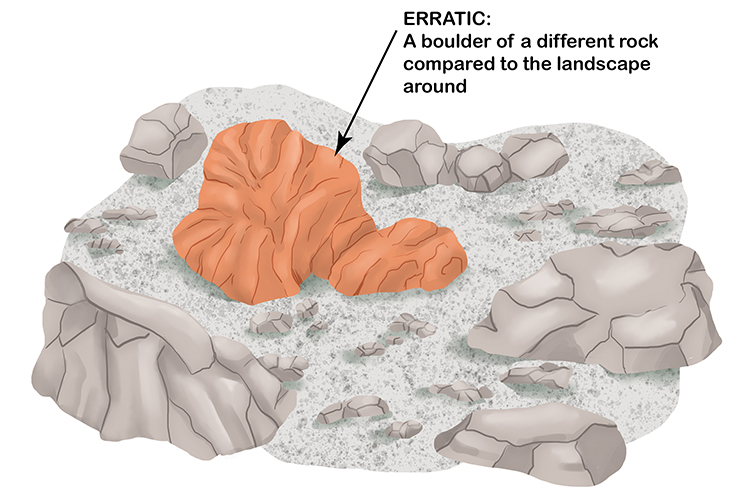
The erratics or boulders don't match the geology of the surrounding landscape.
Erratics were originally produced by glacial erosion and, in some cases, avalanches creating rock falls. They were then transported by the glacier, sometimes up to hundreds of miles, before being deposited. Some were carried on ice "rafts" that originated from glacial ice before sinking to the bottom of lakes or the sea as the rafts melted.
Freeze-Thaw Weathering
Water in rock cracks expands as it freezes, shattering the rock
Freeze-Thaw Weathering – Water in rock cracks expands as it freezes, shattering the rock
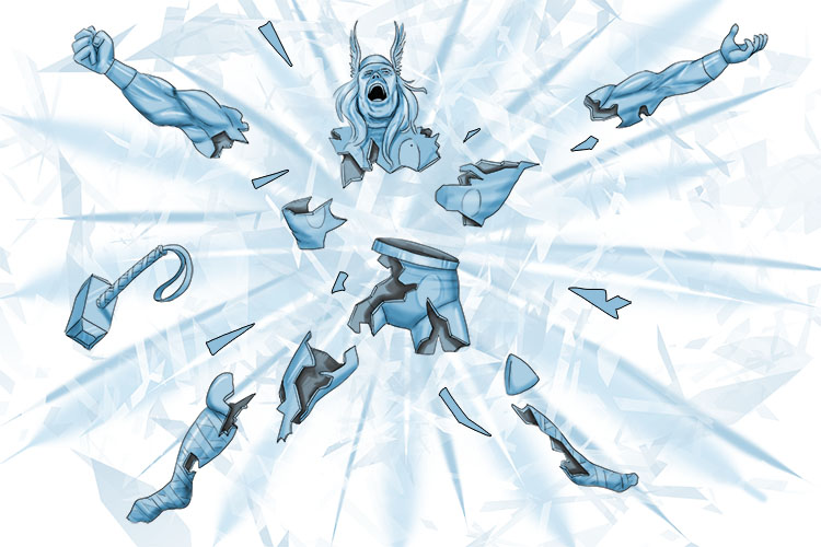
Freezing Thor (freeze-thaw) caused him to shatter.
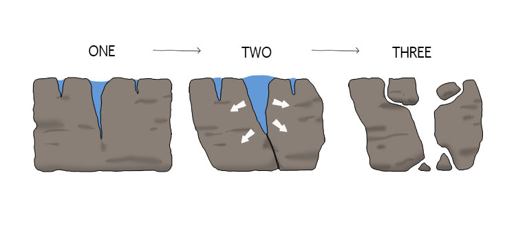
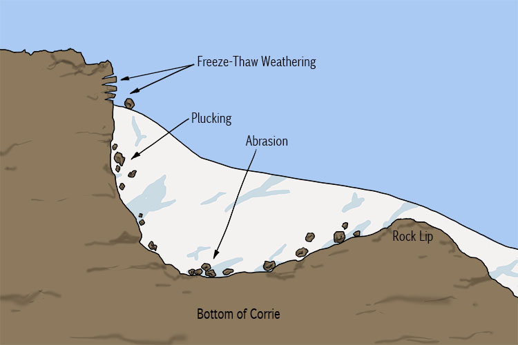
Freeze-thaw weathering (also called frost-shattering) occurs in cold climates when temperatures are often below freezing point and where exposed rocks contain many cracks.
Water enters the cracks during the warmer daylight hours and freezes during the cooler night. As the water freezes it expands, exerting pressure on the surrounding rock, causing pieces to break off.
Glacial Trough
Erosion by glaciers in a "U" shape
Glacial Trough – Erosion by glaciers in a "U" shape
(Pronounced gley-shuhl troff)
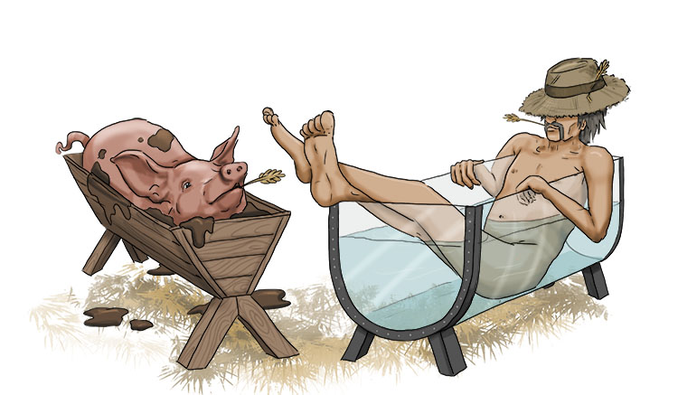
The farmer preferred his glass trough (glacial trough) to the pig's trough. The farmer's trough was "U" shaped and more comfortable.
A glacial trough is a valley widened and deepened by the erosive action of a glacier. The valley becomes U-shaped, rather than the V shape of a normal river valley.
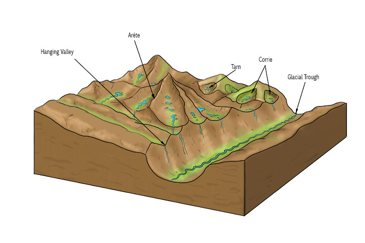
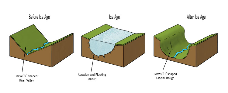
Glacial troughs tend to have steep, straight sides and flattish valley floors. As an example, the Norwegian Fjords are coastal troughs carved out by glaciers.
Hanging Valley
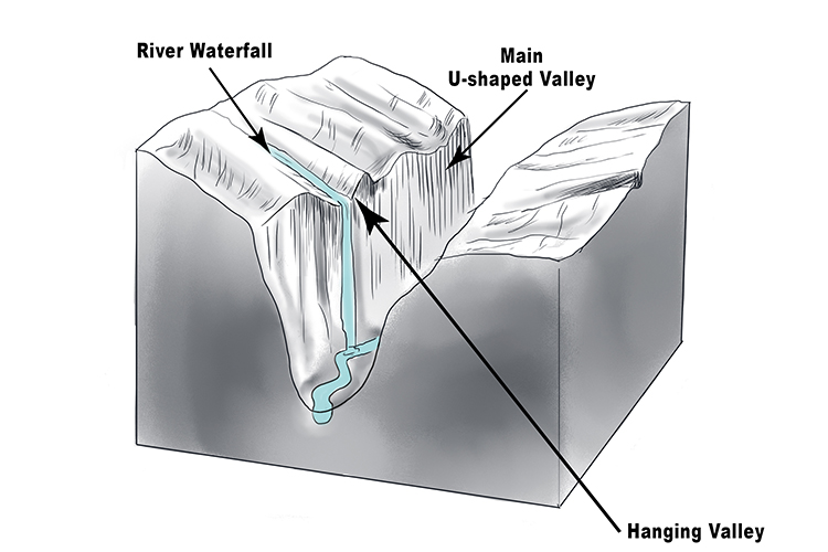
A Tributary Valley high above the main valley
Hanging Valley - A Tributary Valley high above the main valley
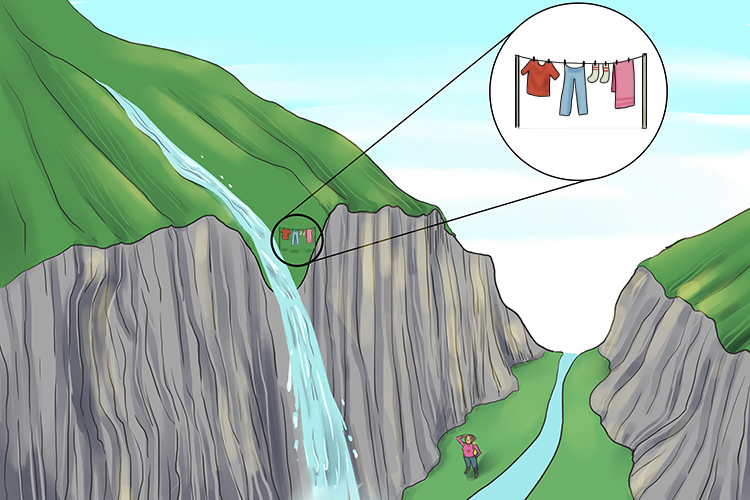
The hanging valley could be seen high up above the main valley she was in.
A hanging valley is a tributary valley to the main glacier, too cold and high up for ice to move easily. It's therefore not eroded as much as the lower main valley, and is often the site of a waterfall crashing several hundred metres to the main valley floor.
Land use conflicts
Disagreements which arise when different users of the land do not agree on how it should be used
Land use conflicts – Disagreements which arise when different users of the land do not agree on how it should be used
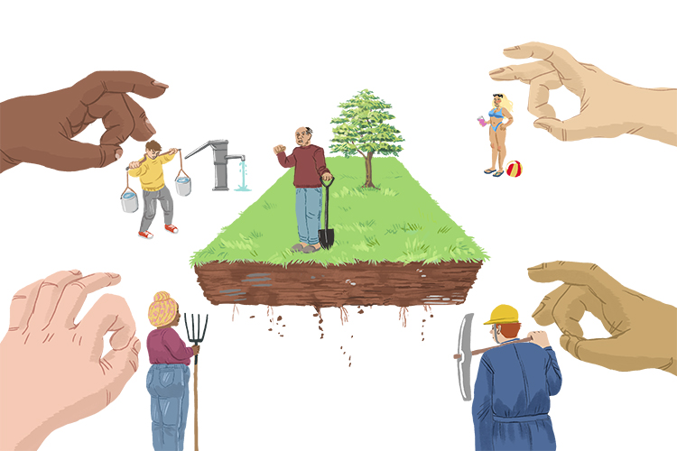
They continue to flick (conflicts) from one to another.
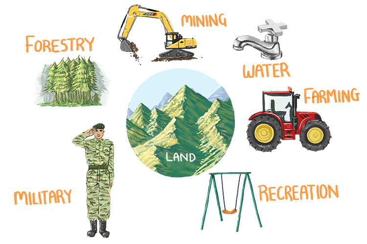
Conflicts over land use can arise, for instance, when lots of tourists visit upland areas of the UK where there are small communities and vulnerable wildlife. Increased traffic can bring noise and air pollution and prevent local people from getting around their area easily. Rare plants may be trampled and littering might detract from the natural beauty of the area and cause pollution.
Huge conflicts can also arise over the development of both industry and housing in previously undeveloped areas. Local people often want their locality to remain unchanged while developers point to the need for more housing and the employment opportunities offered by new sites for business.


