Geography Test Yourself
Here's a really quick way of testing if you've learned the meanings of the key words in this section.
Look at the key word on the card and see if you can remember its definition.
If you get stuck, you can be shown the mnemonic to reveal an image that should help you remember.
To check if you're right, or remind you if you've forgotten, press the card to flip it.
Go through the whole list to see how many definitions you can recall.
Revisit any that you had difficulty remembering until you're confident you can
recall all of them.
River Traction
The rolling of boulders and pebbles along the river bed by the force of the current
Traction – The rolling of boulders and pebbles along the river bed by the force of the current
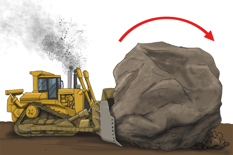
The tractor (traction) could just about roll the big boulder.
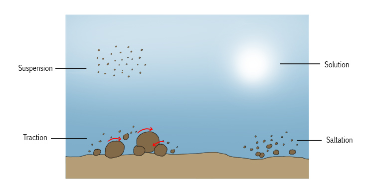
The difference between traction and saltation is that, in traction, the material moved by the force of the river's current does not leave the substratum (the riverbed) at all, but is rolled or slid along.
The continuous contact between the rocks and pebbles that are moved and the substratum can cause erosion, through friction, of both the moving material and the riverbed.
Hydraulic action
Fast-flowing water hits the bed and banks of the river and forces air into cracks in the bedrock. The repeated sudden changes in air pressure cause the cracks to break open further
Hydraulic action – fast-flowing water hits the bed and banks of the river and forces air into cracks in the bedrock. The repeated sudden changes in air pressure cause the cracks to break open further
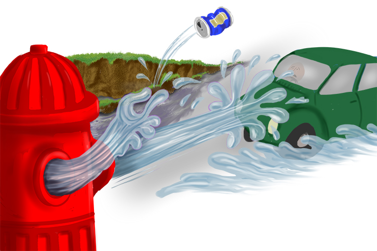
The water hydrant used a flicking action (hydraulic action) to move objects using water.
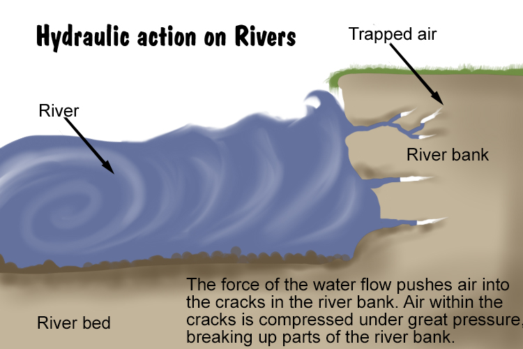
When fast-moving water strikes riverbanks and large rocks, air is forced into cracks. This puts great pressure on the surrounding rock, which can progressively crack, break, and splinter.
This is followed by sudden decompression, which can happen with explosive force. The released air simply blows away pieces of rock. Cracks are gradually widened so that subsequent waves compress more air, increasing the explosive force of its release.
River Abrasion
Rocks carried along by the river wear down the river bed and banks
River Abrasion – Rocks carried along by the river wear down the river bed and banks
(Pronounced uh-bray-zhun)
In order to understand river abrasion you need to understand the word abrasion.
Abrasion – wear down or grind down.
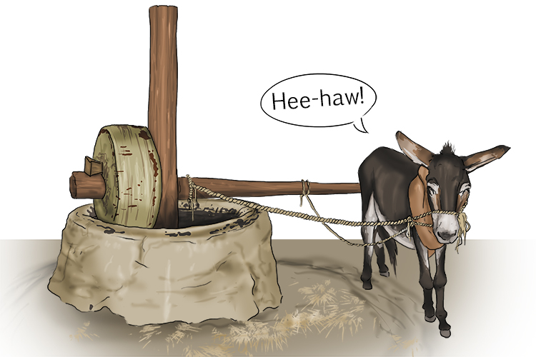
You could hear the brays from (abrasion) the donkey as she wore down and ground down the corn.
So river abrasion is wearing down and grinding down a river's bed and banks.
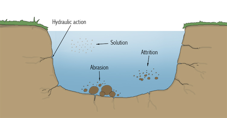
Abrasion is when two surfaces rub against each other and attrition is where they bounce or smash against each other.
Abrasion is nibbling, scratching and scuffing.
Attrition
Rocks being carried by the river smash together and break into smaller, smoother and rounder particles
Attrition – Rocks being carried by the river smash together and break into smaller, smoother and rounder particles
Attrition – think BUMP

A trick with attraction (attrition) is to make sure you bump into the person you are attracted to.
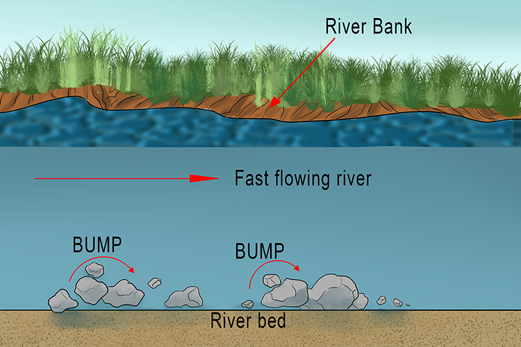
Attrition is where particles and small rocks transported downstream strike each other, and the riverbed, causing them to be broken into smaller fragments and rounding their edges. Attrition is one of the forms of erosion that makes pebbles so smooth and rounded.
Load
The material transported by a river
Load – the material transported by a river
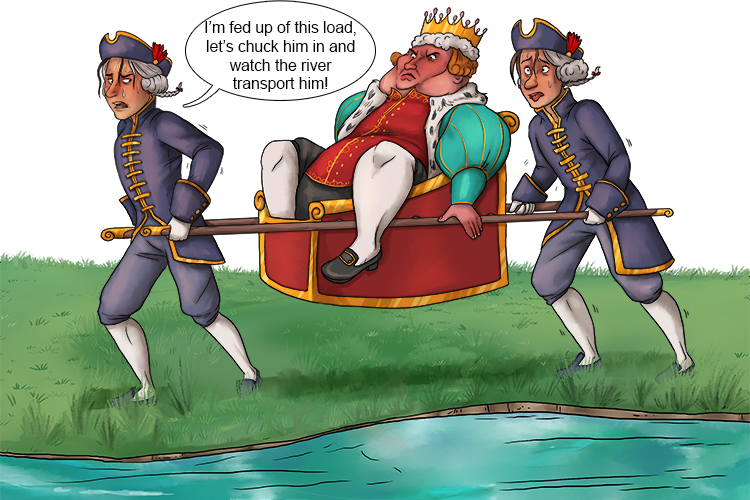
Their load was heavy – so they dropped it in the river and it was transported downstream by the current.
A river picks up material and carries it downstream in four different ways:
Traction, saltation, suspension and solution. The material transported by a river is known as its load.
A river flows faster in its upper reaches and can carry large amounts of sediment (rock particles). When it reaches lower, more even ground, the river slows and the sediment (its load) is deposited. The slower the water moves the more load will be deposited. The load is typically deposited on the inside of the river bends where the slower-moving water has little energy, and towards the end of a river's journey, at the mouth.
Channel Straightening
Removing meanders from a river to make it straighter
Channel Straightening – Removing meanders from a river to make it straighter
Note: Straightening a river (also called channelising) allows it to carry more water quickly downstream, so it doesn't build up and is less likely to flood.
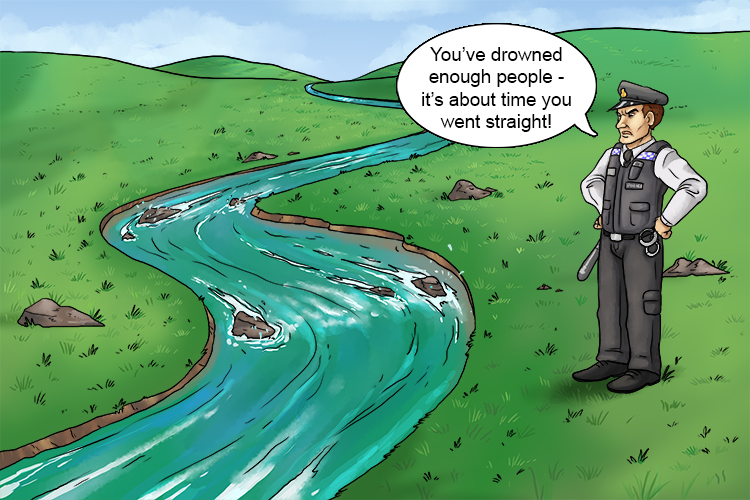
The crooked river channel decided to go straight (channel straightening) after a word from the police.
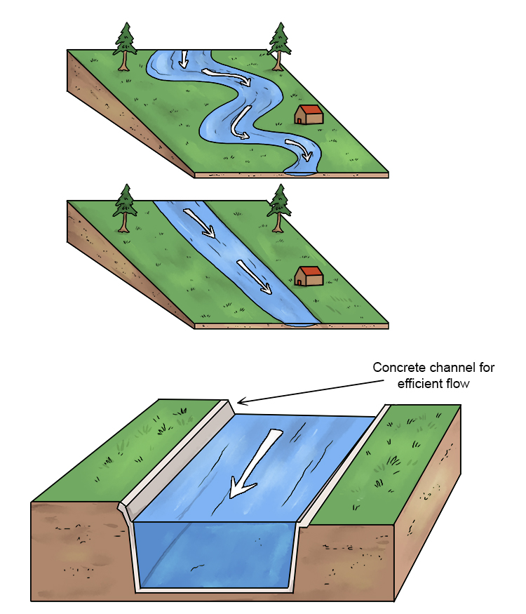
Channel straightening or channelising is a form of hard engineering. Apart from straightening a stretch of river, the procedure often also includes deepening of the channel to greatly increase the flow of water.
For navigable rivers, channel straightening also provides easier and quicker navigation.
Cross-Profile
The side to side cross-section of a river channel and/or valley
Cross-Profile – The side to side cross-section of a river channel and/or valley
CROSS – Think ACROSS
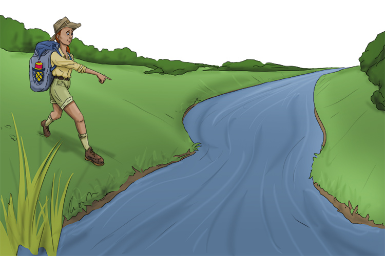
Across this section of the river is the profile (cross profile) she needed. If she knew it was shallow, she might be able to cross this section of the river.
Below is a cross profile of a river:
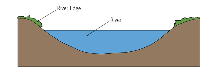
Below is a cross profile of a valley:
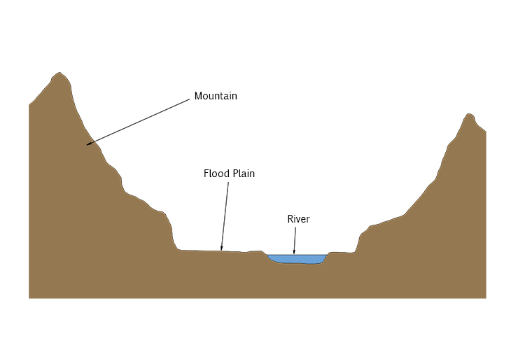
Cross-profiles of a river, taken from different points along the river's journey, show very clearly the differences between the upper and lower reaches of the river. Near the source, the profile shows a relatively narrow, V-shaped profile. Further downstream, nearer the sea, the profile is wider and a gentler U-shape.
Dam and Reservoir
A barrier (made of earth, concrete or stone) built across a valley to interrupt river flow and create a man-made lake (reservoir), which stores water and controls the discharge of the river
Dam and Reservoir – A barrier (made of earth, concrete or stone) built across a valley to interrupt river flow and create a man-made lake (reservoir), which stores water and controls the discharge of the river
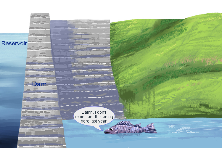
Damn! That's a big dam. The dam was holding back the reservoir.
The advantages of dams and reservoirs, apart from often providing drinking water for large populations, can include a reduction in the risk of flooding during periods of heavy or prolonged rainfall, as flow can be regulated. As water flows through the dam, it might also be used to generate electricity. Storing water in reservoirs can also ensure a constant flow of water, even during extended periods of dry weather.
Of course, there can also be disadvantages. Large areas of land need to be flooded, which can lead to people being displaced, and dams are generally very expensive to construct.
Sediment, transported by the river from its upper reaches, can be deposited in the reservoir. This means sediment is not deposited further down the course of the river, which can reduce soil fertility on the floodplain.
Discharge
The quantity of water that flows past a given point on a stream or river-bank within a given period of time
Discharge – The quantity of water that flows past a given point on a stream or river-bank within a given period of time

He discharged (discharge) his gun as he stood at the start point and thousands (quantity) passed within minutes (time).
This helps to remind you that discharge is the quantity that passes a certain point in a certain time period.
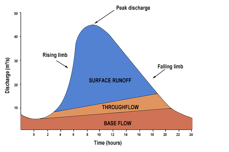
The quantity of water that passes a point in a river is measured in cubic metres per second.
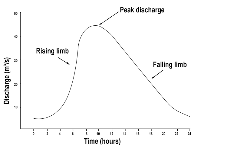
The above is a plot of the average number of cubic metres of water passing a point in a river per second, on a day when there was a rainstorm.
The rising limb shows the discharge increasing due to the storm, then peaking, and then falling, reflecting the storm subsiding and ending.
NOTE: We use the word average because, if you look at the cross-section of a river, the velocity of water passing this one point in the river varies:
Velocity of water per second through
a cut section of a river
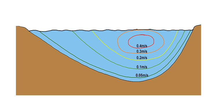
Some clever calculations are made to work out how this translates to the average velocity or speed of the river per second.
The cubic metres of water per second is calculated by multiplying the cross-sectional area of the river by the average of the velocities shown above.
Cubic metre of water per second = Average velocity (m/s) x Area (m²)
The discharge of water at this point in the river is made up of several elements:
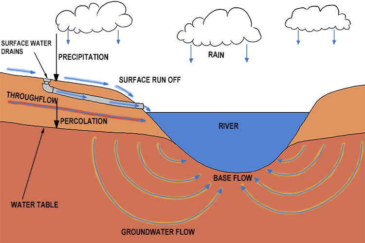
This can be plotted on a graph as follows:
Embankments
Raised banks along the river; they effectively make the river deeper so it can hold more water
Embankments – Raised banks along the river; they effectively make the river deeper so it can hold more water
They are expensive and do not look natural but they do protect the land around them.
Difference between embankments and levees:
- An embankment can hold water and often supports a road or railroad.
- A levee is usually only used to prevent flooding.
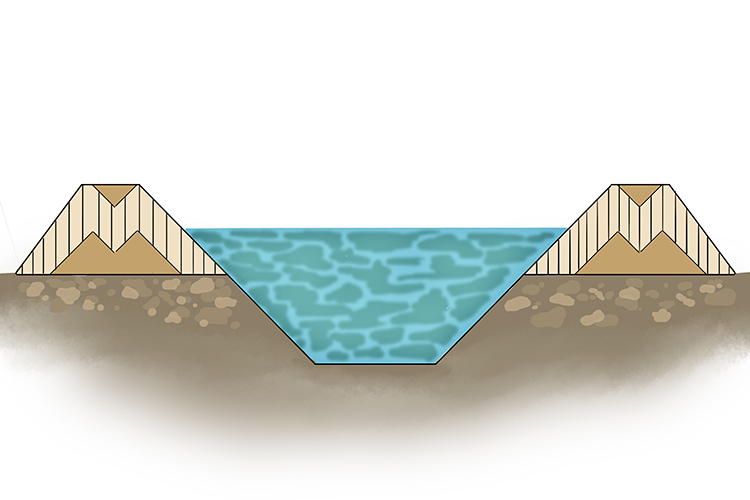
The "M" on the bank is meant (embankment) to protect the land by holding more water.
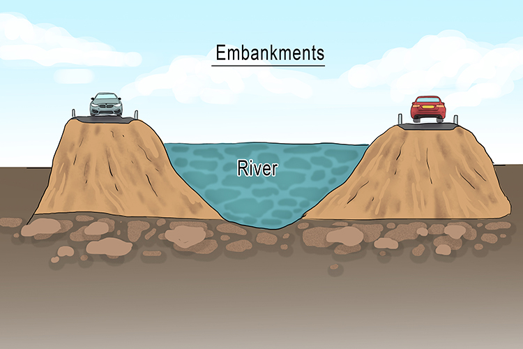
Embankments are hard engineering projects designed to prevent flooding when river levels rise above normal bank height. The advantage is that a stretch of river can hold more water without flooding of adjacent land or property.
The disadvantages of embankments include the high cost of building them and their visual effect on the riverscape.
Experience also shows that if an embankment fails, the subsequent flooding can happen very quickly, with less time for preparation than if flooding had occurred more gradually without an embankment in place.
Clay is often used on the outside of embankments to make them impermiable to water, while sand is often used in the middle.
Estuary
The tidal mouth of a river where it meets the sea; wide banks of deposited mud are exposed at low tide
Estuary – The tidal mouth of a river where it meets the sea; wide banks of deposited mud are exposed at low tide
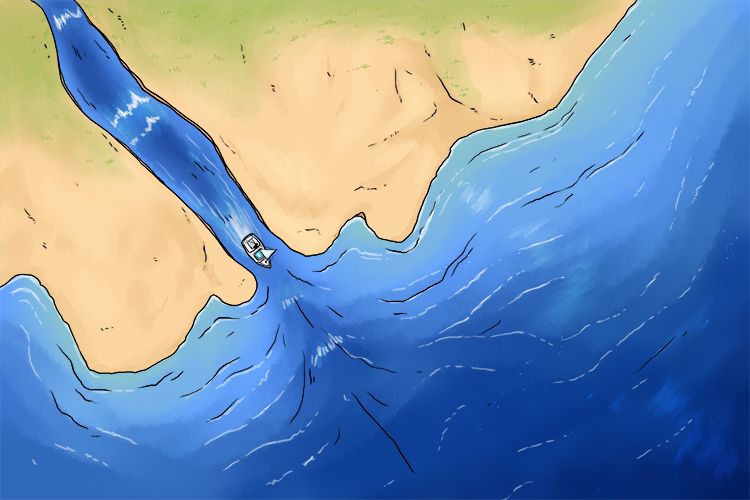
Estimate you are nearly (estuary) at the sea when you reach the mouth of the river.
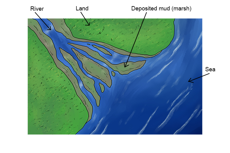
The diagram above is the area of the estuary.
Estuaries are tidal – the level of water rises and falls repeatedly. When the water level in an estuary drops at low tide, the river slows and forms narrow rivulets.
At this point, fine grains of clay and other materials, carried from the river's higher reaches, are deposited in the estuary. The silt that results from this eventually forms into mudflats, which are an important habitat for wildlife.
This is why estuaries are home to unique animal and plant communities that have adapted to brackish water – a mixture of fresh water draining from the land and salty seawater.
Large numbers of wading birds are often attracted to estuaries because of the colonies of worms, molluscs and crustaceans that they contain.
Flood
Occurs when river discharge exceeds river channel capacity and water spills out of the channel into the flood plain and other areas
Flood – Occurs when river discharge exceeds river channel capacity and water spills out of the channel into the flood plain and other areas
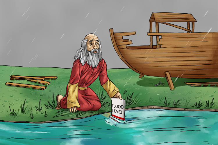
The great flood: When Noah saw that river discharge was exceeding river channel capacity he rather sensibly built an ark.
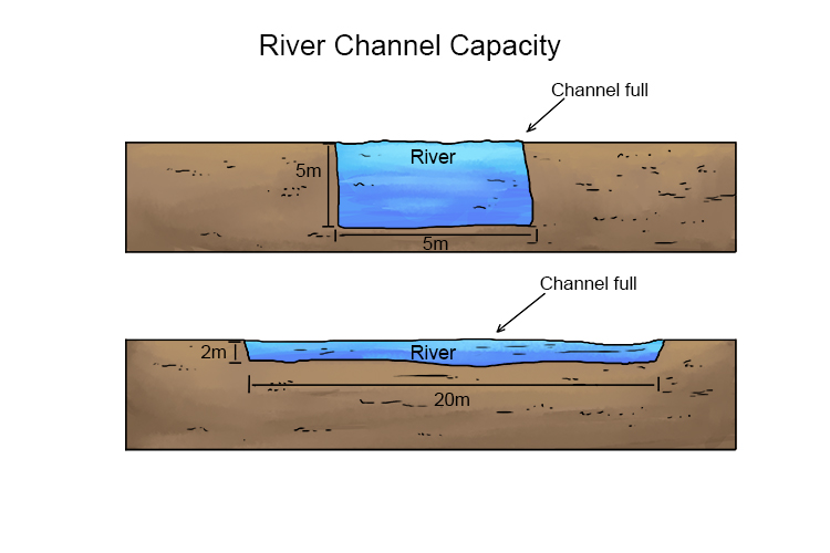
Floods are caused by heavy rainfall or the rapid melting of ice.
While this can cause major problems for people living and working in areas that are prone to flooding, floods have beneficial effects, too.
Floods deposit rich alluvium (deposits of clay, silt and sand) in agricultural areas, making the land more fertile; and flood water can replenish irrigation channels, again aiding agriculture.
Flood Relief Channels
Building new artificial channels which are used when a river is close to maximum discharge
Flood Relief Channels – Building new artificial channels which are used when a river is close to maximum discharge
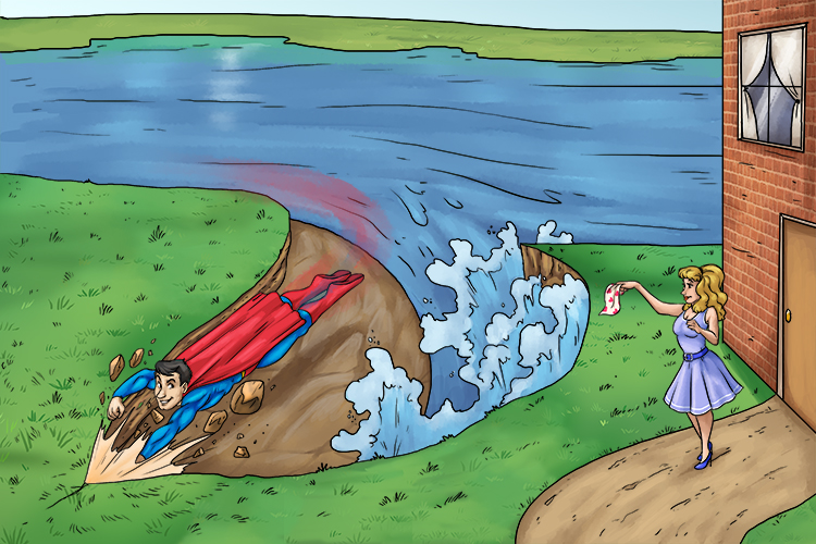
She felt a flood of relief (flood relief) when the channel was opened and the water threatening her home receded.
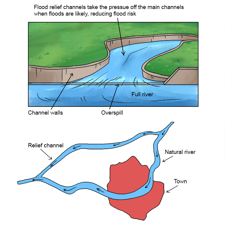
A flood relief channel takes the pressure off a river's main channel when flooding is likely, thereby reducing flood risk.
For instance, a relief channel might bypass a town or city, so that flooding in the urban area becomes far less likely.
However, it can be difficult to source land for the construction of flood relief channels, and building them is very expensive.
Flood plain
The relatively flat area forming the valley floor on either side of a river channel, which is sometimes flooded
Flood plain – The relatively flat area forming the valley floor on either side of a river channel, which is sometimes flooded
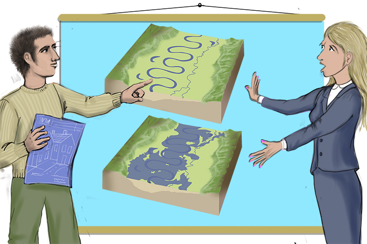
Floods occur here, plain (flood plain) and simple. No, you can't build a house here.
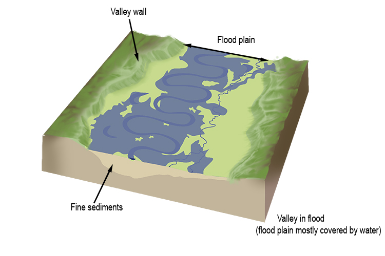
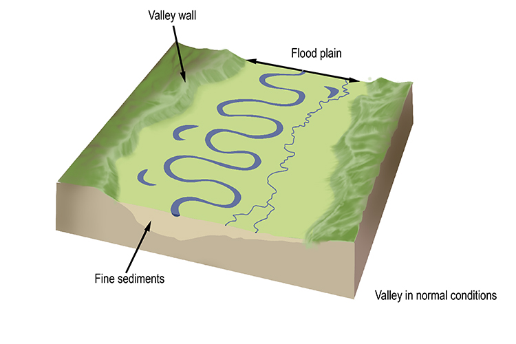
Flood plains have their advantages – chiefly that they are rich in fertile sediment that is deposited on the land by the floods, which can be to the benefit of both wildlife and agriculture.
Over recent years, however, they have become the focus of concern as climate change has brought more severe floods. This has resulted in misery for many people whose homes and businesses have been flooded. It has also brought into question the wisdom of building homes in certain areas.
For government, it has meant a rethinking of some policies and spending on often expensive systems to give relief to those with homes in flood-risk areas.
Flood plain zoning
This is a way of organising flood defences and ensuring that land which often floods is not built on
Flood plain zoning – This is a way of organising flood defences and ensuring that land which often floods is not built on
NOTE: This land could be used for pastoral farming and playing fields.

Floods occur here, plain and simple, so this zone (flood plain zoning) must not be built on.
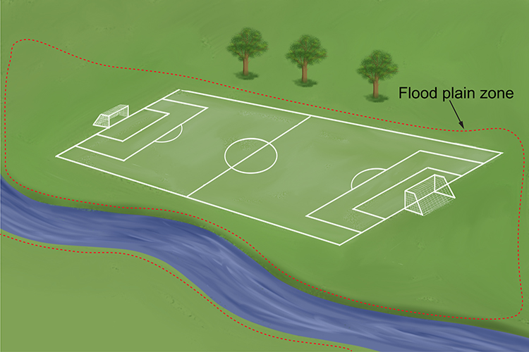
Flood plain zoning is a system for setting the level of flooding risk for different areas of a country. Governments can then make laws regarding development work in the different zones.
For instance, in the UK, the Environment Agency has divided areas into three main zones: 1, 2 and 3. Flood zone 1 covers areas least likely to flood, and flood zone 3 is for areas where flooding is most likely.
This means that in zone 1, there are very few if any restrictions on development relating to flooding; in zones 2 and 3, prospective developers must submit a flood risk assessment before a planning application can be considered.
The types of development that can be carried out in zones 2 and 3 are strictly controlled.
Flood Warning
Providing reliable advance information about possible flooding. Flood warning systems give people time to remove possessions and evacuate areas
Flood Warning – Providing reliable advance information about possible flooding. Flood warning systems give people time to remove possessions and evacuate areas

Providing reliable, advance information about flooding is vital for communities under threat.
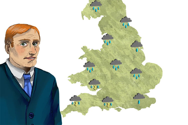
Warnings about floods are an important part of weather forecasts on TV and radio.
Countries' environmental agencies monitor rainfall, ice melt and river levels and issue warnings via newspapers, TV, radio and the internet when flooding is likely, so people can prepare.
This gives people time to try to protect their properties with sandbags and other means.
With timely warnings, many possessions can be saved.
However, some people – particularly those in less developed countries – may not be able to access the warnings.
In some cases, flash floods happen too quickly for a warning to be effective, even in highly developed countries.
Forecasting when floods will occur, and when they will reach their peak, is a complex task. It includes assessing the volume of rain, the speed of rainfall run-off and the rate of discharge of river channels. However, real-time flood forecasting for specific areas can be done by leading-edge artificial neural networks.
Flood Risk
The predicted frequency of floods in an area
Flood Risk – The predicted frequency of floods in an area
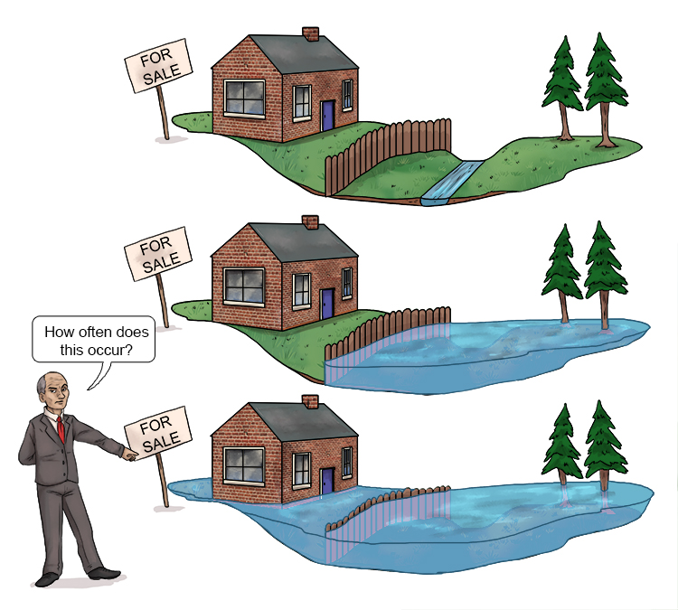
The flood put the house at risk every time (flood risk). The prospective owner asked "How often does this occur?"
A lot of rain falling in a short period of time can cause a flood – but there are further factors involved that make some areas more prone to flooding than others.
The topography – for instance, whether you are on a hillside or at the bottom of the valley – the ability of the land to soak up or impede movement of water, and the presence or lack of vegetation are all factors that affect the likelihood of flooding.
Apart from studying these factors, the risk of flooding in a particular area is based on statistics – how often floods have occurred there in the past.
In most countries, the relevant agencies keep maps that show the flood risk for each area. For instance, in the USA, the Federal Emergency Management Agency (FEMA) is the official public source for flood risk maps for insurance and other purposes.
Fluvial Processes
Processes relating to erosion, transport and deposition by a river
Fluvial Processes – Processes relating to erosion, transport and deposition by a river
(Pronounced floo-vee-uhl)
The way to remember fluvial processes is to first learn what fluvial means.
Definition of fluvial = of or relating to a river.
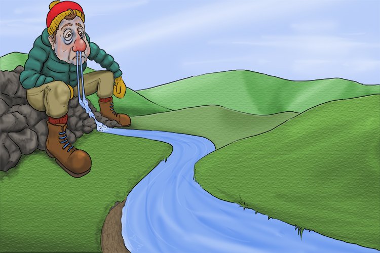
The flu was so vile (fluvial) that there was a river coming out of his nose.
So, now we know fluvial relates to rivers, it's clear that fluvial processes are really river processes.
River processes include:
- Erosion (wearing away of riverbed and banks)
- Transportation (river material transported along the river)
- Deposition (river material deposited)
As rain falls and collects in watercourses, erosion degrades the land, and the products of erosion themselves become the tools with which rivers carve out valleys.
Sediment materials eroded from one location are transported and deposited in another, only to be eroded and redeposited repeatedly before reaching the ocean.
Fluvial processes continue for eons. For instance, it is estimated that the Mississippi started flowing around 70 million years ago, when dinosaurs still roamed earth.
Gorge
A narrow, steep sided valley, sometimes formed as a waterfall retreats upstream
Gorge – A narrow, steep sided valley, sometimes formed as a waterfall retreats upstream
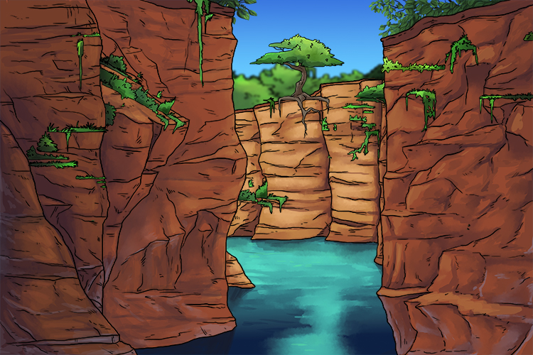
What a gorgeous view (gorge) of a narrow, steep-sided valley. Often with a waterfall at the end.
So, how are gorges formed?
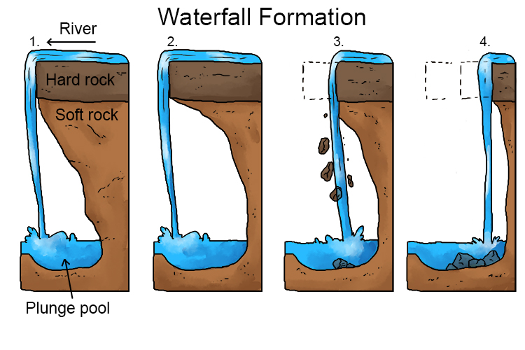
- Waterfalls typically form in the upper stages of a river. They occur when a band of hard rock overlies a softer rock. Falling water and rock particles erode the soft rock below the waterfall, creating a plunge pool.
- The soft rock is undercut by erosional processes such as hydraulic action and abrasion, creating a plunge pool where water and debris swirl around, eroding the rock and creating an overhang.
- The hard rock overhang above the plunge pool collapses as its weight is no longer supported.
- Erosion continues and the waterfall retreats upstream, leaving behind a gorge.
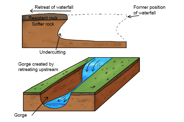
Note: Gorges can also form when meltwater floods flow after numerous cold periods or "ice ages", or by cavern collapse abrasion.
A gorge is a narrow valley with steep, rocky walls. Gorges are usually smaller than canyons, although both words are used to describe deep, narrow valleys with a stream or river running along the bottom.
Apart from retreating waterfalls, gorges can also be formed by other natural actions, including the movement and melting of glaciers, the collapse of caverns or caves, geologic uplift (the elevation of earth's surface due to natural causes) and rivers and streams simply 'carving' through layers of rock over millions of years.
Important geological discoveries have been made at gorges because they expose layers of rock that go back millions of years. For instance, the Olduvai Gorge in Tanzania has layers dating as far back as two million years and is famous for the fossils and ancient tools found there.
Hard Engineering
The building of artificial structures using materials such as rock, concrete and steel, to reduce, disrupt or stop the impact of the erosion process in rivers
Hard Engineering – The building of artificial structures using materials such as rock, concrete and steel, to reduce, disrupt or stop the impact of the erosion process in rivers
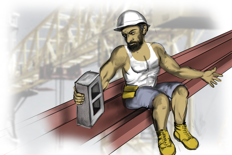
The hard engineer (hard engineering) loved his concrete block.
Hard engineering in rivers include:
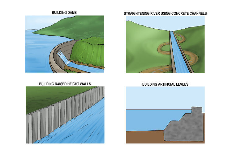
Hard engineering in river landscapes involves the building of artificial structures to control rivers. Such projects tend to be expensive.
Hard engineering strategies have advantages and disadvantages, for instance:
| River straightening | Dams and reservoirs |
| Advantages | - More water can be held in the channel, reducing flood risk
- Can improve the river as a shipping route
- Silt from the river makes an excellent fertiliser
| - Can be used to produce electricity by placing a turbine within the dam.
- Many reservoirs supply water to towns and cities
- Some reservoirs become tourist attractions
|
| Disadvantages | - Speeding up the river increases flood risk downstream.
- Visual intrusion: the natural appearance of the river's course is lost
- High cost
| - Dams trap sediment, so reservoir can silt up and hold less water.
- Habitats are flooded, destroying ecosystems
- Homes and settlements may be lost, leading to displacement of people
- Expensive
|


